Latitude: 51.703 / 51°42'10"N
Longitude: -1.1784 / 1°10'42"W
OS Eastings: 456875
OS Northings: 200788
OS Grid: SP568007
Mapcode National: GBR 8ZT.2XG
Mapcode Global: VHCY2.JGDC
Plus Code: 9C3WPR3C+5M
Entry Name: 4
Listing Date: 18 July 1963
Last Amended: 19 August 1986
Grade: II
Source: Historic England
Source ID: 1047995
English Heritage Legacy ID: 248405
ID on this website: 101047995
Location: Toot Baldon, South Oxfordshire, OX44
County: Oxfordshire
District: South Oxfordshire
Civil Parish: Toot Baldon
Traditional County: Oxfordshire
Lieutenancy Area (Ceremonial County): Oxfordshire
Church of England Parish: Marsh Baldon with Toot Baldon and Nuneham Courtenay
Church of England Diocese: Oxford
Tagged with: Building
TOOT BALDON 5P5600 8/167 No.4 18/07/63 (Formerly listed as pair of cottages 60 yards ESE of Court House Farm)
GV II
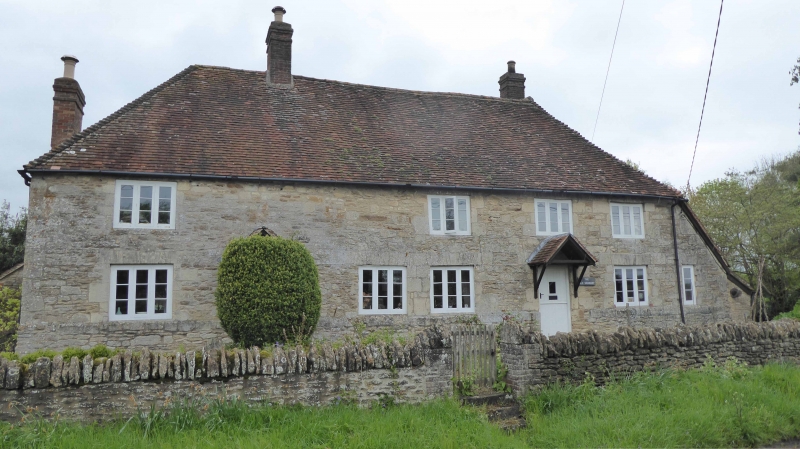
House. Early C18, possibly partly earlier. Limestone rubble with ashlar dressings; timber framing with brick infill; old plain-tile roof with brick stacks. L-plan with end outshut. 2 storeys. 4-window rubble front, with plinth and stone flat arches, has entrance to left plus, at ground floor, four 3-light casements and a second doorway, to right, probably converted from a fifth window; 4 similar casements at first floor. Wall continues to extreme right, containing a matching single-light casement serving the outshut. Roof is hipped, continuing to right over the outshut. Roof and outshut return on right to rear wing. Ridge stack, to left of centre, is almost in line with the entrance and there are further stacks on the ridge of the rear wing and added to the left end wall. Rear of main range and wing retain some timber framing. Interior not inspected.
Listing NGR: SP5687500788
External links are from the relevant listing authority and, where applicable, Wikidata. Wikidata IDs may be related buildings as well as this specific building. If you want to add or update a link, you will need to do so by editing the Wikidata entry.


Other nearby listed buildings