Latitude: 53.0776 / 53°4'39"N
Longitude: -0.9549 / 0°57'17"W
OS Eastings: 470108
OS Northings: 353883
OS Grid: SK701538
Mapcode National: GBR BK3.5DD
Mapcode Global: WHFHF.9XJ1
Plus Code: 9C5X32HW+22
Entry Name: Old Grammar School
Listing Date: 9 February 1973
Last Amended: 20 May 1992
Grade: II
Source: Historic England
Source ID: 1046152
English Heritage Legacy ID: 242336
ID on this website: 101046152
Location: Southwell, Newark and Sherwood, Nottinghamshire, NG25
County: Nottinghamshire
District: Newark and Sherwood
Civil Parish: Southwell
Built-Up Area: Southwell
Traditional County: Nottinghamshire
Lieutenancy Area (Ceremonial County): Nottinghamshire
Church of England Parish: Southwell St Mary the Virgin
Church of England Diocese: Southwell and Nottingham
Tagged with: Building
SOUTHWELL
CHURCH STREET SK7053 1919-0/11/45 (South side) 09/02/73 Old Grammar School (Formerly Listed as: CHURCH STREET The Old Grammar School (PW Gascoine and others))
GV II
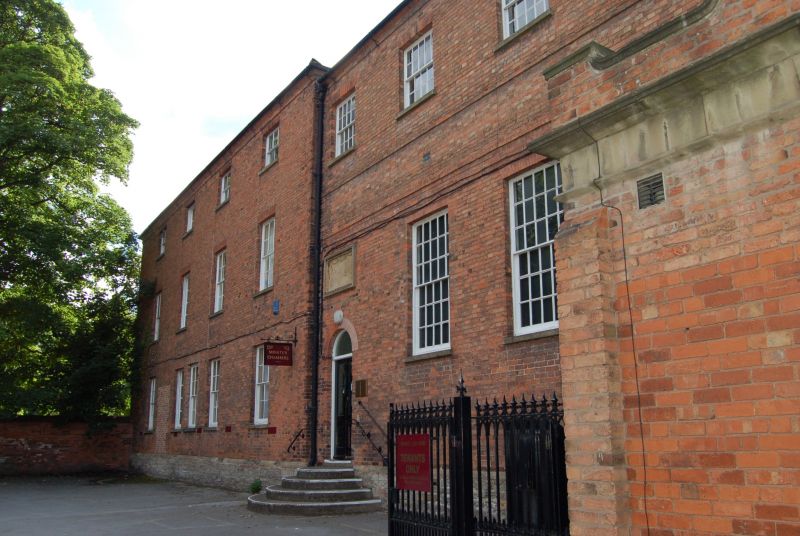
Former Grammar School, now offices. 1819, with late C19 additions. Brick with dressed stone plinth and hipped and gabled slate roof. 2 string courses, chamfered eaves, single gable, ridge and side wall stacks. Windows are glazing bar sashes of various sizes, with rubbed brick heads. 3 storeys, 3x6 bays. Pedimented north gable, to street, has a central blank flanked by single windows on each floor, those to the upper floor being smaller. In a recess to the right, a round headed doorway with plain fanlight and above it, a single sash on each floor. To left, a late C19 flat roofed porch with cornice and ramped parapet, and a 3-light mullioned window. On its left side, a doorway. Above the porch, a tablet inscribed "Collegiate Grammar School of Southwell". Hipped end, to Minster churchyard, has regular fenestration with a central full-height sash on the ground floor. Interior has a stone dogleg stair with stick balusters.
Listing NGR: SK7010853883
External links are from the relevant listing authority and, where applicable, Wikidata. Wikidata IDs may be related buildings as well as this specific building. If you want to add or update a link, you will need to do so by editing the Wikidata entry.


Other nearby listed buildings