Latitude: 53.1421 / 53°8'31"N
Longitude: -0.7666 / 0°45'59"W
OS Eastings: 482601
OS Northings: 361260
OS Grid: SK826612
Mapcode National: GBR CKX.502
Mapcode Global: WHFHB.6971
Plus Code: 9C5X46RM+R9
Entry Name: The Nunnery
Listing Date: 16 January 1967
Grade: II
Source: Historic England
Source ID: 1046048
English Heritage Legacy ID: 242597
ID on this website: 101046048
Location: Collingham, Newark and Sherwood, Nottinghamshire, NG23
County: Nottinghamshire
District: Newark and Sherwood
Civil Parish: Collingham
Built-Up Area: Collingham
Traditional County: Nottinghamshire
Lieutenancy Area (Ceremonial County): Nottinghamshire
Church of England Parish: Collingham
Church of England Diocese: Southwell and Nottingham
Tagged with: Building
SK 8261-8361 COLLINGHAM SOUTH END (north side)
10/72 The Nunnery 16.1.67 G.V. II
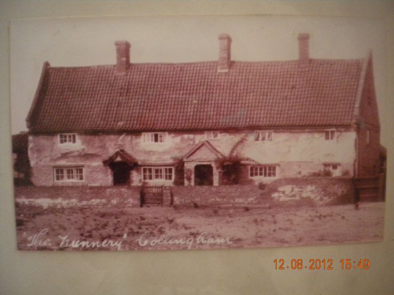
Farmhouse, late C16. Coursed blue lias rubble and brick, timber framing with pargetted rendering,steep pitched C20 pantile roof, brick coped gables, off-centre ridge stack, eaves level brick band. 2 storeys with garrets, 3 bays, 5 windows, L-plan. Off-centre C20 part glazed south door with timber lintel, flanked by single C19 3 light glazing bar Yorkshire sashes; beyond, C20 rubble gabled porch with C20 close boarded door; beyond,C19 3-light glazing bar sash and single C20 3 light casement both with timber lintels. Above, central C20 3 light casement flanked to south by single C19 2 light and single 3 light glazing bar Yorkshire sashes, to north by 2 C20 3 light glazing bar casements. North gable has single C20 2 light glazing bar casement; in gable, triangular opening with pigeon holes.
Listing NGR: SK8260161260
External links are from the relevant listing authority and, where applicable, Wikidata. Wikidata IDs may be related buildings as well as this specific building. If you want to add or update a link, you will need to do so by editing the Wikidata entry.


Other nearby listed buildings