Latitude: 53.0199 / 53°1'11"N
Longitude: -0.988 / 0°59'16"W
OS Eastings: 467979
OS Northings: 347436
OS Grid: SK679474
Mapcode National: GBR 9JB.P0H
Mapcode Global: WHFHS.SCP6
Plus Code: 9C5X2296+XQ
Entry Name: The Smithy
Listing Date: 13 March 1986
Grade: II
Source: Historic England
Source ID: 1045552
English Heritage Legacy ID: 242009
ID on this website: 101045552
Location: Gonalston, Newark and Sherwood, Nottinghamshire, NG14
County: Nottinghamshire
District: Newark and Sherwood
Civil Parish: Gonalston
Traditional County: Nottinghamshire
Lieutenancy Area (Ceremonial County): Nottinghamshire
Church of England Parish: Gonalston
Church of England Diocese: Southwell and Nottingham
Tagged with: Smithy
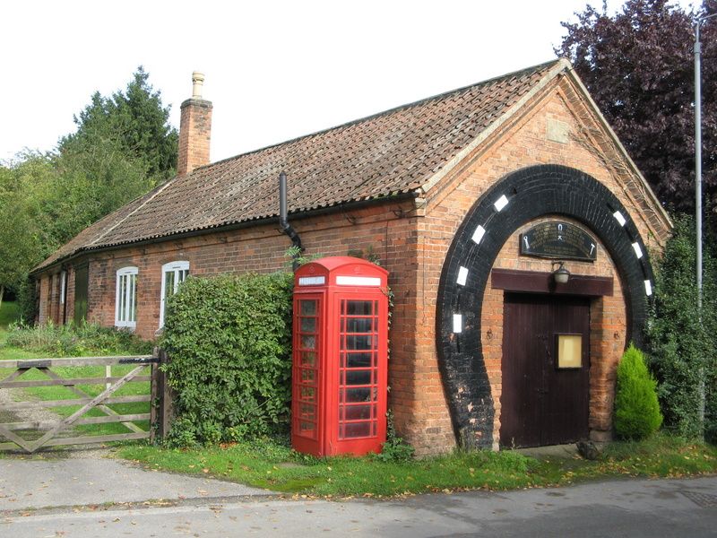
GONALSTON HOVERINGHAM ROAD SK 64 NE (north side) 4/57 The Smithy II Smithy. Dated 1845. Red brick. Pantile roof. Single C20 red brick ridge stack. Raised brick eaves. Single storey, single bay road/gable front. Central doorway with double plank door and wooden lintel. Over is a C20 inscribed board. Encompassing this and the doorway is a large painted brick horse shoe. In the apex is an ashlar plaque inscribed "J F 1845". The west 7 bay front of various builds has 2 Yorkshire sashes under segmental arches, to the left is a doorway with double plank door, a single glazing bar casement and further left 3 doorways with plank doors.
Listing NGR: SK6797947436
External links are from the relevant listing authority and, where applicable, Wikidata. Wikidata IDs may be related buildings as well as this specific building. If you want to add or update a link, you will need to do so by editing the Wikidata entry.


Other nearby listed buildings