Latitude: 53.0294 / 53°1'45"N
Longitude: -1.0288 / 1°1'43"W
OS Eastings: 465230
OS Northings: 348448
OS Grid: SK652484
Mapcode National: GBR 9J8.4P8
Mapcode Global: WHFHS.53CY
Plus Code: 9C5W2XHC+PF
Entry Name: The Old Forge and Attached Outbuildings
Listing Date: 21 January 1986
Grade: II
Source: Historic England
Source ID: 1045545
English Heritage Legacy ID: 242100
ID on this website: 101045545
Location: Epperstone, Newark and Sherwood, Nottinghamshire, NG14
County: Nottinghamshire
District: Newark and Sherwood
Civil Parish: Epperstone
Built-Up Area: Epperstone
Traditional County: Nottinghamshire
Lieutenancy Area (Ceremonial County): Nottinghamshire
Church of England Parish: Epperstone
Church of England Diocese: Southwell and Nottingham
Tagged with: Smithy
SK 64 NE EPPERSTONE MAIN STREET (south side)
9/44 The Old Forge and attached outbuild- 21.1.86 ings
G.V. II
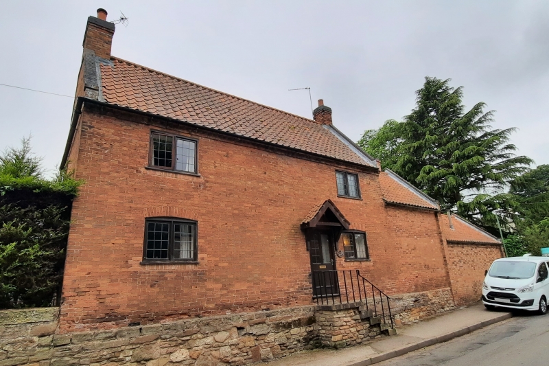
House and attached outbuildings. Mid C18. Red brick with a rubble and brick plinth. Plain tile roof. 2 red brick gable stacks, the left also rendered. Brick coped gables with kneelers. Dogtooth eaves. 2 storeys, 3 bays. Single flight of five ashlarsteps with iron hand rail leads to the doorway with panelled door. Either side are single casements under segmental arches. Above are 2 similar casements. To the right is a single storey plus garret, 2 bay red brick and pantile range on a similar plinth with 2 blocked segmental arched doorways. Further right is a single storey red brick and pantile range with similar plinth to the left, no openings.
Listing NGR: SK6523048448
External links are from the relevant listing authority and, where applicable, Wikidata. Wikidata IDs may be related buildings as well as this specific building. If you want to add or update a link, you will need to do so by editing the Wikidata entry.


Other nearby listed buildings