Latitude: 55.029 / 55°1'44"N
Longitude: -2.286 / 2°17'9"W
OS Eastings: 381814
OS Northings: 570532
OS Grid: NY818705
Mapcode National: GBR DBG9.W1
Mapcode Global: WH90R.VVLL
Plus Code: 9C7V2PH7+HH
Entry Name: Hadrians Wall, Milcastles and Turrets
Listing Date: 24 November 1967
Grade: I
Source: Historic England
Source ID: 1045249
English Heritage Legacy ID: 240792
ID on this website: 101045249
Location: Northumberland, NE47
County: Northumberland
Civil Parish: Simonburn
Traditional County: Northumberland
Lieutenancy Area (Ceremonial County): Northumberland
Church of England Parish: Simonburn
Church of England Diocese: Newcastle
Tagged with: Defensive wall
SIMONBURN B 6318 NY 87 SW and NY 87 SE (North side, off) 8/108 and 9/108 Hadrian's wall, milecastles and 24.11.67 turrets I
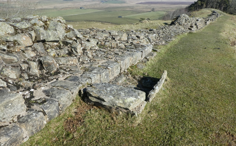
Hadrian's wall; milecastles 30, 31, 34 and 35; turrets 29B, 30A, 30B, 33B, 34A and 35A. AD 122, reconstructed AD 205. Rubble core with dressed stone faces. Course of wall runs through 2 sections of Simonburn parish: west from near Black Carts Farm (NY 883713) to Brocolita Roman Fort (NY 856712); west from near Shield on the Wall (NY825706) to Sewingshields Crags (NY 800700). Several stretches of well-preserved 1.0 to 1.5-metre high wall masonry. Remains of milecastles 30 and 35 and of turret 35A; sites only of other milecastles and turrets. Scheduled Ancient Monuments.
Listing NGR: NY8181470532
External links are from the relevant listing authority and, where applicable, Wikidata. Wikidata IDs may be related buildings as well as this specific building. If you want to add or update a link, you will need to do so by editing the Wikidata entry.


Other nearby listed buildings