Latitude: 53.4474 / 53°26'50"N
Longitude: -0.8299 / 0°49'47"W
OS Eastings: 477812
OS Northings: 395147
OS Grid: SK778951
Mapcode National: GBR QXNK.4Y
Mapcode Global: WHFFR.7M21
Plus Code: 9C5XC5WC+W3
Entry Name: Access Bridge at Pumping Engine Houses
Listing Date: 23 November 1984
Grade: II
Source: Historic England
Source ID: 1045082
English Heritage Legacy ID: 241178
ID on this website: 101045082
Location: Bassetlaw, Nottinghamshire, DN10
County: Nottinghamshire
District: Bassetlaw
Civil Parish: Misterton
Built-Up Area: Misterton
Traditional County: Nottinghamshire
Lieutenancy Area (Ceremonial County): Nottinghamshire
Church of England Parish: West Stockwith
Church of England Diocese: Southwell and Nottingham
Tagged with: Building Road bridge
SK 79 NE MISTERTON SOSS ROAD (east side)
3/94 Access bridge at pumping engine houses
G.V. II
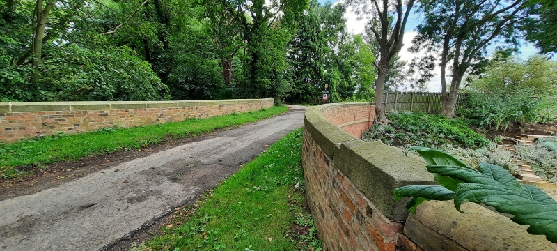
Access road bridge, c.1803, brick with stone coping, soffit and imposts. Single stilted segmental arch, curved brick parapet with stone coping, linked with boundary wall of south engine house.
Listing NGR: SK7781295147
External links are from the relevant listing authority and, where applicable, Wikidata. Wikidata IDs may be related buildings as well as this specific building. If you want to add or update a link, you will need to do so by editing the Wikidata entry.


Other nearby listed buildings