Latitude: 55.1468 / 55°8'48"N
Longitude: -1.9016 / 1°54'5"W
OS Eastings: 406366
OS Northings: 583605
OS Grid: NZ063836
Mapcode National: GBR H85X.3V
Mapcode Global: WHB1H.RWNT
Plus Code: 9C7W43WX+P8
Entry Name: Corridge Farmhouse
Listing Date: 20 October 1969
Grade: II
Source: Historic England
Source ID: 1042856
English Heritage Legacy ID: 238434
ID on this website: 101042856
Location: Northumberland, NE61
County: Northumberland
Civil Parish: Wallington Demesne
Traditional County: Northumberland
Lieutenancy Area (Ceremonial County): Northumberland
Church of England Parish: Hartburn with Meldon
Church of England Diocese: Newcastle
Tagged with: Farmhouse
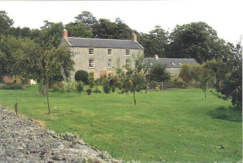
WALLINGTON DEMESNE CORRIDGE NZ 08 SE NZ 064836 14/185 Corridge Farmhouse 20.10.69 GV II House, mid C17, refenestrated and 2nd floor added late C18. Large rubble with dressings; slate roof except for stone slates on outshut. 'T' plan. South front 3 storeys, 3 bays, symmetrical. Central part-glazed C19 door in surround with moulding stepped at head, and hoodmould; 16-pane sash windows to ground and 1st floors, with traces of earlier openings in end bays. 2nd floor shortened 12-pane sashes; all windows in raised stone surrounds. Coped gables, end stacks rebuilt in brick. Returns show open-pedimented gables. Rear wing has open- pedimented gable with brick stack and,on east, vertical-panelled door with 6-pane overlight in tooled-and-margined chamfered surround. Older blocked doorway with flattened 4-centred head to right; various sashes including a tall 18-pane stair window above the door. To west of wing, outshut has small-paned casements in chamfered tooled-and-margined surrounds, with heavy iron bars.
Interior altered in C19. Plain winder stair in rear wing.
Listing NGR: NZ0636683605
External links are from the relevant listing authority and, where applicable, Wikidata. Wikidata IDs may be related buildings as well as this specific building. If you want to add or update a link, you will need to do so by editing the Wikidata entry.


Other nearby listed buildings