Latitude: 55.1622 / 55°9'44"N
Longitude: -1.6831 / 1°40'59"W
OS Eastings: 420290
OS Northings: 585370
OS Grid: NZ202853
Mapcode National: GBR J8PR.F9
Mapcode Global: WHC2R.3HTX
Plus Code: 9C7W5868+VQ
Entry Name: Morpeth Station
Listing Date: 22 August 1986
Grade: II
Source: Historic England
Source ID: 1042760
English Heritage Legacy ID: 238709
Also known as: MPT
ID on this website: 101042760
Location: Stobhillgate, Northumberland, NE61
County: Northumberland
Civil Parish: Morpeth
Built-Up Area: Morpeth
Traditional County: Northumberland
Lieutenancy Area (Ceremonial County): Northumberland
Church of England Parish: Morpeth
Church of England Diocese: Newcastle
Tagged with: Railway station
MORPETH COOPIES LANE NZ 2085
25/224 Morpeth Station
GV II
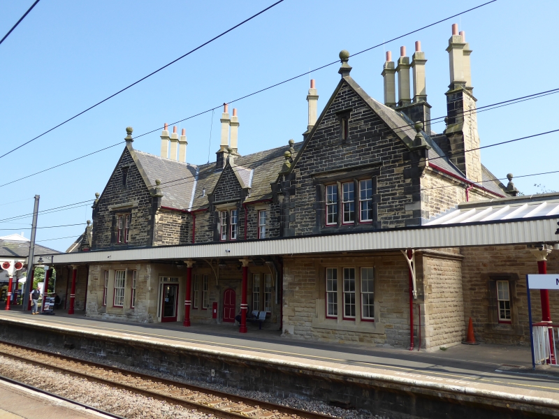
British Rail Station. 1847 by John Green for the York, Newcastle and Berwick Railway. bm canopies added c.1890 (cf. Whittingham Station and Callaly Castle Stables). Dressed stone with ashlar dressings. Welsh slate roof. Tudor style. 2-storey, U-plan centre section and single-storey wings.
Centre section: recessed middle with Tudor-arched doorway to left and platform access to right; 2-light windows above in gabled half-dormers. Projecting, cross-gabled outer bays. To right: 3 large pointed-arched windows on ground floor and canted oriel above. To left: 3-light mullioned windows. Steeply- pitched gabled roof with ridged coping, kneelers with ball finials, and low octagonal ridge stacks.
Similar detail to wings.
Platform side has glazed canopies with elaborate iron work, including stars of David, in the spandrels. Platform extension to east has similar canopy on cast- iron columns.
Ceramic railway map of c.1910, attached to wall.
Railway Stations of the North East: Hoole: 1985. David and Charles.
Listing NGR: NZ2035185364
External links are from the relevant listing authority and, where applicable, Wikidata. Wikidata IDs may be related buildings as well as this specific building. If you want to add or update a link, you will need to do so by editing the Wikidata entry.


Other nearby listed buildings