Latitude: 54.9711 / 54°58'16"N
Longitude: -2.1002 / 2°6'0"W
OS Eastings: 393684
OS Northings: 564061
OS Grid: NY936640
Mapcode National: GBR FBSY.3S
Mapcode Global: WHB2C.Q93X
Plus Code: 9C6VXVCX+FW
Entry Name: 19, Hallgate
Listing Date: 18 May 1976
Grade: II
Source: Historic England
Source ID: 1042594
English Heritage Legacy ID: 239111
ID on this website: 101042594
Location: Hexham, Northumberland, NE46
County: Northumberland
Civil Parish: Hexham
Built-Up Area: Hexham
Traditional County: Northumberland
Lieutenancy Area (Ceremonial County): Northumberland
Church of England Parish: Hexham
Church of England Diocese: Newcastle
Tagged with: Building
HALLGATE 1. (South West Side) 5334 No 19 NY 9364 1/242
II GV
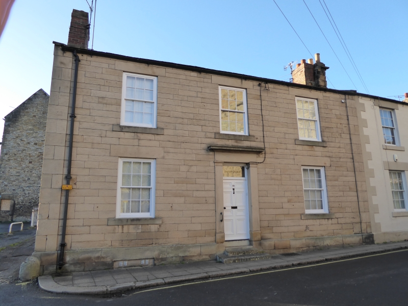
2. Early-mid C19. 2 storeys. 3 windows. Ashlar with pier strips at side. Sash windows, plateglass. Central doorcase with plain pilasters and hood.
The Manor Office, together with Nos 15 to 19 (consec) Hall Bank House, Bankhead and Manor Cottage and Archway form a group of which Nos 15 and 16 Hallgate are of local interest.
Listing NGR: NY9368464061
External links are from the relevant listing authority and, where applicable, Wikidata. Wikidata IDs may be related buildings as well as this specific building. If you want to add or update a link, you will need to do so by editing the Wikidata entry.


Other nearby listed buildings