Latitude: 55.7704 / 55°46'13"N
Longitude: -2.0002 / 2°0'0"W
OS Eastings: 400082
OS Northings: 653011
OS Grid: NU000530
Mapcode National: GBR G1GQ.R9
Mapcode Global: WH9YK.77R4
Plus Code: 9C7VQXCX+5W
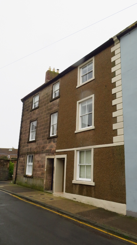
Entry Name: 71 and 73, Ravensdowne
Listing Date: 1 August 1952
Grade: II
Source: Historic England
Source ID: 1042403
English Heritage Legacy ID: 237449
ID on this website: 101042403
Location: Berwick-upon-Tweed, Northumberland, TD15
County: Northumberland
Civil Parish: Berwick-upon-Tweed
Built-Up Area: Berwick-upon-Tweed
Traditional County: Northumberland
Lieutenancy Area (Ceremonial County): Northumberland
Church of England Parish: Berwick Holy Trinity and St Mary
Church of England Diocese: Newcastle
Tagged with: Building
1.
840
NU 0053
11/189
1.8.52
RAVENSDOWNE
(West Side)
Nos 71 & 73
II
2.
C18. Ashlar, with quoins. Pantiled roof, 3 storeys, 3 windows.
Listing NGR: NU0008253011
External links are from the relevant listing authority and, where applicable, Wikidata. Wikidata IDs may be related buildings as well as this specific building. If you want to add or update a link, you will need to do so by editing the Wikidata entry.


Other nearby listed buildings