Latitude: 55.2453 / 55°14'42"N
Longitude: -1.7696 / 1°46'10"W
OS Eastings: 414743
OS Northings: 594586
OS Grid: NZ147945
Mapcode National: GBR J72S.NJ
Mapcode Global: WHC29.SFH8
Plus Code: 9C7W66WJ+44
Entry Name: The Old Vicarage
Listing Date: 20 October 1969
Last Amended: 30 January 1986
Grade: II
Source: Historic England
Source ID: 1042098
English Heritage Legacy ID: 238321
ID on this website: 101042098
Location: Longhorsley, Northumberland, NE65
County: Northumberland
Civil Parish: Longhorsley
Built-Up Area: Longhorsley
Traditional County: Northumberland
Lieutenancy Area (Ceremonial County): Northumberland
Church of England Parish: Longhorsley St Helen
Church of England Diocese: Newcastle
Tagged with: Clergy house
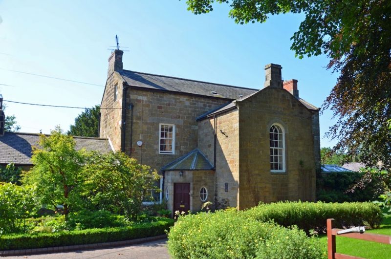
LONGHORSLEY LONGHORSLEY NZ 19 SW 5/89 The Old Vicarage 20.10.69 (Formerly listed as The Vicarage) GV II Former vicarage. Early C19. Squared tooled stone, slate roof. T-plan. 2 storeys + attics, 3 bays. Central rendered porch has French window with 2-pane fanlight under elliptical arch, and flanking 9-pane fixed windows. To either side 3-light mullioned windows hold late C19 sashes; late C19 sash windows to 1st floor, 3 gabled dormers with C20 casements above. Coped gables with moulded kneelers, brick end stacks on stone bases. Set-back right 1-storey, 3-bay section with stone ridge stack; lower l-bay extension to far right. Rear elevation: central gabled stair wing shows 15-pane sash window with intersecting glazing bars in round-arched head. To right and left extruded single-storey canted projections: left has flush-panelled door flanked by small-oval lights, right has 6-pane Yorkshire sash.
Described as "newly built" in 1826.
Listing NGR: NZ1474394586
External links are from the relevant listing authority and, where applicable, Wikidata. Wikidata IDs may be related buildings as well as this specific building. If you want to add or update a link, you will need to do so by editing the Wikidata entry.


Other nearby listed buildings