Latitude: 55.3084 / 55°18'30"N
Longitude: -1.9087 / 1°54'31"W
OS Eastings: 405895
OS Northings: 601598
OS Grid: NU058015
Mapcode National: GBR H731.KW
Mapcode Global: WHB0Q.NT9V
Plus Code: 9C7W835R+9G
Entry Name: Rothbury Bridge
Listing Date: 21 October 1953
Grade: II
Source: Historic England
Source ID: 1041932
English Heritage Legacy ID: 236608
ID on this website: 101041932
Location: Rothbury, Northumberland, NE65
County: Northumberland
Civil Parish: Rothbury
Built-Up Area: Rothbury
Traditional County: Northumberland
Lieutenancy Area (Ceremonial County): Northumberland
Church of England Parish: Upper Coquetdale
Church of England Diocese: Newcastle
ROTHBURY BRIDGE STREET NU 0501 25/263 Rothbury Bridge 21.10.53 GV II
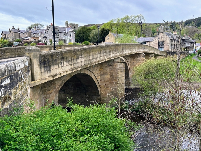
Bridge. Medieval; south arch rebuilt C16 or C17; widened to east 1759; new superstructure mid-C20. Squared stone. 4 segmental, almost semicircular arches which are double-chamfered to the west and have arch rings to the east. The 3 northern arches each have 4 chamfered soffit ribs; plain soffits to southern arch and 1759 widening, Pointed cutwaters, those on west with canted tops. Flat-coped C19 approach walls on north.
The date 1759 and initials W.O. (William Oliphant, a Rothbury mason) are said to be carved low on the east face.
C20 concrete and steel superstructure, extending over cutwaters and replacing original parapets, is not of interest.
Listing NGR: NU0589501598


Other nearby listed buildings