Latitude: 55.4116 / 55°24'41"N
Longitude: -1.7048 / 1°42'17"W
OS Eastings: 418785
OS Northings: 613119
OS Grid: NU187131
Mapcode National: GBR J5JV.PW
Mapcode Global: WHC1K.S7CP
Plus Code: 9C7WC76W+M3
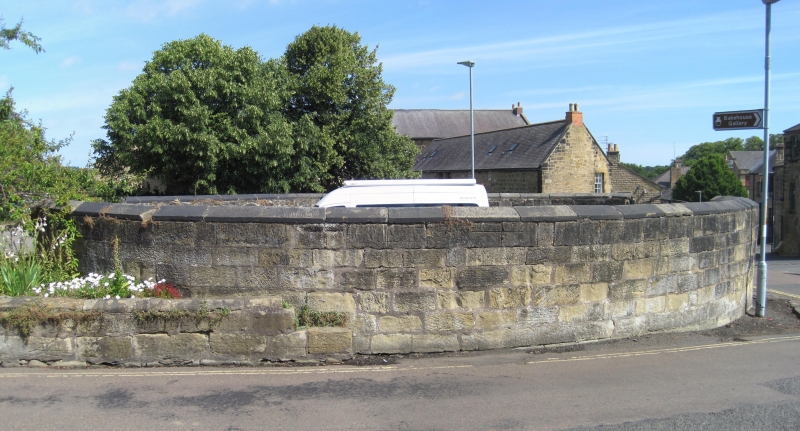
Entry Name: The Pinfold
Listing Date: 25 August 1977
Grade: II
Source: Historic England
Source ID: 1041477
English Heritage Legacy ID: 235725
ID on this website: 101041477
Location: Alnwick, Northumberland, NE66
County: Northumberland
Civil Parish: Alnwick
Built-Up Area: Alnwick
Traditional County: Northumberland
Lieutenancy Area (Ceremonial County): Northumberland
Church of England Parish: Alnwick
Church of England Diocese: Newcastle
Tagged with: Building
GREEN BATT 1. 5330 The Pinfold NU 1815 SE 1/255 II 2. Former pound removed to present position in 1819 from Bondgate Without (near present War Memorial, qv). Ashlar built about 5-6 ft high, oval-shaped, about 12x15 1/2 yards.
Listing NGR: NU1878613118
External links are from the relevant listing authority and, where applicable, Wikidata. Wikidata IDs may be related buildings as well as this specific building. If you want to add or update a link, you will need to do so by editing the Wikidata entry.


Other nearby listed buildings