Latitude: 53.3119 / 53°18'42"N
Longitude: -1.4593 / 1°27'33"W
OS Eastings: 436125
OS Northings: 379574
OS Grid: SK361795
Mapcode National: GBR LZ74.WH
Mapcode Global: WHDF2.K0BW
Plus Code: 9C5W8G6R+Q7
Entry Name: Two Farm Buildings to East of Norwood Farmhouse
Listing Date: 4 May 1978
Grade: II
Source: Historic England
Source ID: 1040044
English Heritage Legacy ID: 79514
ID on this website: 101040044
Location: Coal Aston, North East Derbyshire, S18
County: Derbyshire
District: North East Derbyshire
Civil Parish: Dronfield
Built-Up Area: Dronfield
Traditional County: Derbyshire
Lieutenancy Area (Ceremonial County): Derbyshire
Church of England Parish: Dronfield St John Baptist
Church of England Diocese: Derby
Tagged with: Building
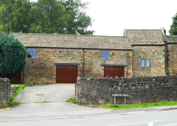
PARISH OF DRONFIELD ECKINGTON ROAD SK 37 NE 6/34 Two farm buildings 4.5.78 to the east of Norwood Farmhouse GV II Farm outbuildings. Mid C18 and early C19. Coursed coal measures sandstone with quoins and stone slated roofs. Two storeys, four bays, the west bay taller and with coped gables and moulded kneelers. Single 2-light flush mullioned window to west and north elevations and a quoined doorway. Remaining three bays advanced, with three doorways and two overloft windows, all irregularly spaced. Lower single storey addition to east end with stone slated roof. Included for group value only.
Listing NGR: SK3612579574
External links are from the relevant listing authority and, where applicable, Wikidata. Wikidata IDs may be related buildings as well as this specific building. If you want to add or update a link, you will need to do so by editing the Wikidata entry.


Other nearby listed buildings