Latitude: 51.336 / 51°20'9"N
Longitude: 0.0535 / 0°3'12"E
OS Eastings: 543144
OS Northings: 161655
OS Grid: TQ431616
Mapcode National: GBR NV.L5R
Mapcode Global: VHHP9.WP46
Plus Code: 9F3283P3+9C
Entry Name: Walnut Tree Cottage
Listing Date: 29 June 1973
Last Amended: 31 October 1983
Grade: II
Source: Historic England
Source ID: 1038563
English Heritage Legacy ID: 358516
ID on this website: 101038563
Location: Downe, Bromley, London, BR6
County: London
District: Bromley
Electoral Ward/Division: Darwin
Parish: Non Civil Parish
Built-Up Area: Downe
Traditional County: Kent
Lieutenancy Area (Ceremonial County): Greater London
Church of England Parish: Downe St Mary Magdalene
Church of England Diocese: Rochester
Tagged with: Cottage
in the entry for:-
LUXTED ROAD, DOWNE Group of 4 Cottages at Junction 12/155 of High Street & Luxted Road
the address shall be amended to read as follows:- LUXTED ROAD, DOWNS Nos 1 to 3 (consec) (Walnut Tree Cottages)
------------------------------------
1. LUXTED ROAD, DOWNE 4407 Group of 4 cottages at Junction of High Street & Luxted Road TQ 46 SW 12/155
II
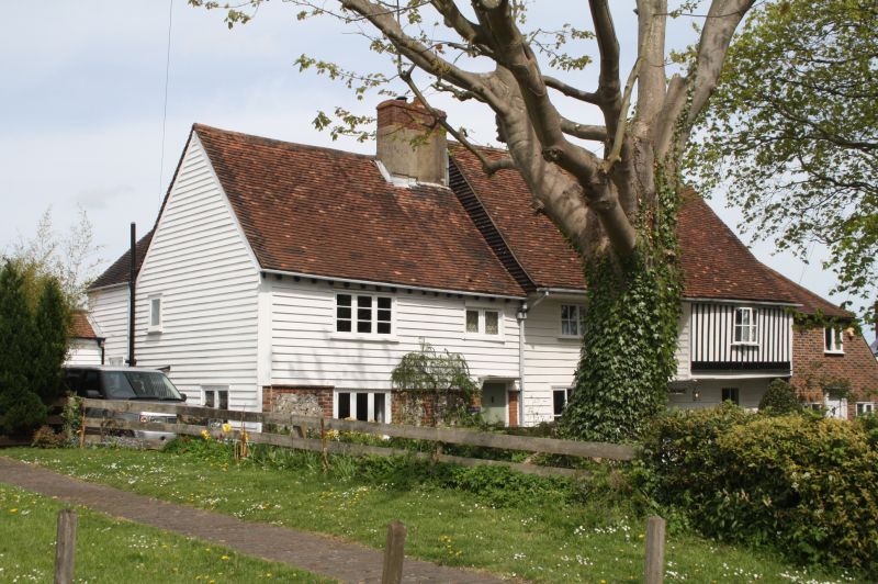
2. Timber-framed but refaced in C18. 2 storeys. The ground floor is flint faced with brick quoins. The 1st floor is weatherboarded. Tiled roof having part moulded eaves cornice and part modillion cornice. Mostly C19 casements.
Listing NGR: TQ4314461655
External links are from the relevant listing authority and, where applicable, Wikidata. Wikidata IDs may be related buildings as well as this specific building. If you want to add or update a link, you will need to do so by editing the Wikidata entry.


Other nearby listed buildings