Latitude: 51.3198 / 51°19'11"N
Longitude: -1.877 / 1°52'37"W
OS Eastings: 408669
OS Northings: 157863
OS Grid: SU086578
Mapcode National: GBR 3WX.09V
Mapcode Global: VHB4Q.F322
Plus Code: 9C3W849F+W6
Entry Name: 67, the Street
Listing Date: 25 March 1988
Grade: II
Source: Historic England
Source ID: 1035826
English Heritage Legacy ID: 312015
ID on this website: 101035826
Location: Marden, Wiltshire, SN10
County: Wiltshire
Civil Parish: Marden
Traditional County: Wiltshire
Lieutenancy Area (Ceremonial County): Wiltshire
Tagged with: Building
MARDEN THE STREET SU 05 NE (west side) 3/111 No 67 GV II
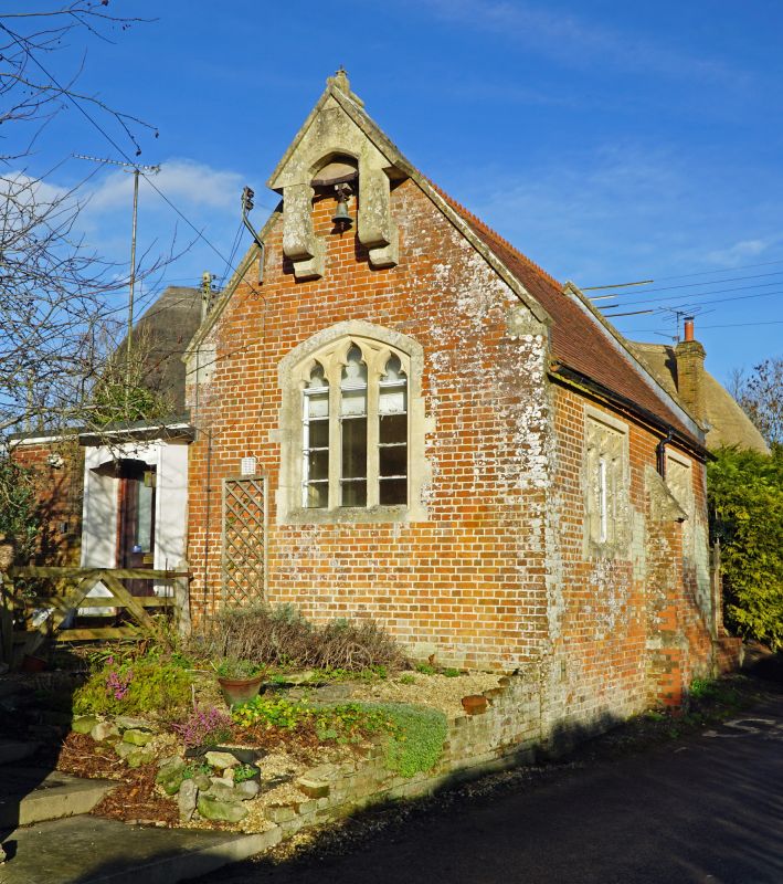
Schoolroom, now dwelling. 1844. Flemish brickwork with tiled roof and pierced crestings. Single storey, 2 bays, with buttress to central truss. Square headed stone doorcase to east end, having spandrel and 2-centred arch, now window. Stone windows with 3 trefoiled lights, square headed to side, but low 2-centred arched head to gable. Cantilevered bellcote to west gable with pitched roof. Small extension on north side, containing entrance.
Listing NGR: SU0866657864
External links are from the relevant listing authority and, where applicable, Wikidata. Wikidata IDs may be related buildings as well as this specific building. If you want to add or update a link, you will need to do so by editing the Wikidata entry.


Other nearby listed buildings