Latitude: 51.3177 / 51°19'3"N
Longitude: -1.8951 / 1°53'42"W
OS Eastings: 407408
OS Northings: 157629
OS Grid: SU074576
Mapcode National: GBR 3WW.7QN
Mapcode Global: VHB4Q.34HN
Plus Code: 9C3W8493+3X
Entry Name: 61, the Street
Listing Date: 25 March 1988
Grade: II
Source: Historic England
Source ID: 1035810
English Heritage Legacy ID: 311977
ID on this website: 101035810
Location: Chirton, Wiltshire, SN10
County: Wiltshire
Civil Parish: Chirton
Built-Up Area: Chirton
Traditional County: Wiltshire
Lieutenancy Area (Ceremonial County): Wiltshire
Church of England Parish: Chirton and Patney St John the Baptist
Church of England Diocese: Salisbury
Tagged with: Building
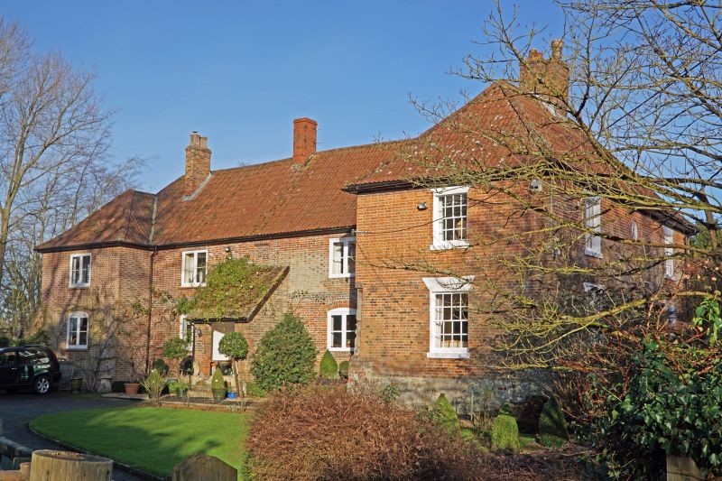
CHIRTON THE STREET SU 05 NE (north end) 3/73 No 61 II Farmhouse, now house. C15, C17 and 18, altered early C19. Timber framed on Malmstone base, refaced in brick in C18, with pantiled roof. Two storeys L-plan, front block originally a 2 bay lobby entry plan with central entrance, a 6-panelled door with flat stone canopy on brackets. Plat band, flanking early C19 sixteen-pane sashes with painted wedge lintels and sills. Central stack. Roof hipped. Timber framing exposed on right gable and rear, 3 panels high with internal tension braces. Rear wing to right, of 3 bays, with central lean-to porch and C19 casement windows, those to ground floor with segmental arches. Flush 5-course vitrified brick plat band. Internally, rear wing contains two roof trusses and numerous smoke blackened timbers of late C15-early C16, and central room on ground has late medieval moulded cross beams. Roof reconstructed-around chalkstone and parged stack with stone drip mould now internal. Early C19 stair at junction with front block, which has two C18 bolection moulded timber fire surrounds in right parlour and room over.
Listing NGR: SU0740557640
External links are from the relevant listing authority and, where applicable, Wikidata. Wikidata IDs may be related buildings as well as this specific building. If you want to add or update a link, you will need to do so by editing the Wikidata entry.


Other nearby listed buildings