Latitude: 52.3408 / 52°20'27"N
Longitude: -1.7602 / 1°45'36"W
OS Eastings: 416435
OS Northings: 271445
OS Grid: SP164714
Mapcode National: GBR 4JZ.CS8
Mapcode Global: VH9ZR.FFTC
Plus Code: 9C4W86RQ+8W
Entry Name: Mountford Farmhouse
Listing Date: 11 April 1967
Grade: II
Source: Historic England
Source ID: 1035111
English Heritage Legacy ID: 308288
ID on this website: 101035111
Location: Lapworth, Warwick, Warwickshire, B94
County: Warwickshire
District: Warwick
Civil Parish: Lapworth
Traditional County: Warwickshire
Lieutenancy Area (Ceremonial County): Warwickshire
Church of England Parish: Lapworth with Kingswood
Church of England Diocese: Birmingham
Tagged with: Farmhouse
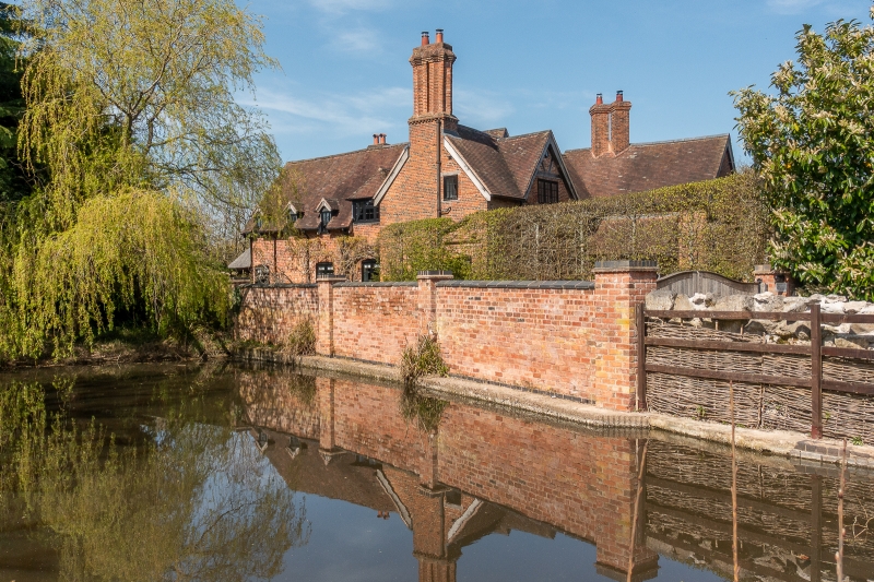
LAPWORTH CHURCH LANE SP17SE (West side) 1/26 Mountford Farmhouse 11/04/67 - II Farmhouse. C16. C18 brick encasement and C18 crosswing to right of centre. Red brick; old plain-tile complex roof; brick end stack to left with star-shaped flues, ridge stack to right of centre with diagonally-set flues. Complex plan. 2-storey, 4-bay range with cross-wing with C20 lean-to hood. Irregular fenestration of casements. Collar-truss roof truss with queen-struts to cross-gable at left of centre. Interior not inspected. (VCH: Warwickshire: Vol.5: 1949, pp108-l16) [ 35]
Listing NGR: SP1643571445
External links are from the relevant listing authority and, where applicable, Wikidata. Wikidata IDs may be related buildings as well as this specific building. If you want to add or update a link, you will need to do so by editing the Wikidata entry.


Other nearby listed buildings