Latitude: 50.6288 / 50°37'43"N
Longitude: -1.1742 / 1°10'27"W
OS Eastings: 458506
OS Northings: 81333
OS Grid: SZ585813
Mapcode National: GBR 9DS.HZ6
Mapcode Global: FRA 87FD.VSV
Plus Code: 9C2WJRHG+G8
Entry Name: The Vicarage
Listing Date: 14 February 1992
Grade: II
Source: Historic England
Source ID: 1034299
English Heritage Legacy ID: 310241
ID on this website: 101034299
Location: St Saviour's on the Cliff, Shanklin, Isle of Wight, PO37
County: Isle of Wight
Civil Parish: Shanklin
Built-Up Area: Shanklin
Traditional County: Hampshire
Lieutenancy Area (Ceremonial County): Isle of Wight
Church of England Parish: Shanklin St Saviour-on-the-Cliff
Church of England Diocese: Portsmouth
Tagged with: Clergy house
SHANKLIN SZ5881 QUEEN'S ROAD 1352-0/8/207 The Vicarage GV II
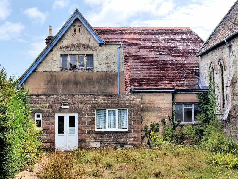
Purpose-built vicarage. c1870 by William Woodyer. Ground floor of stone rubble, 1st floor tile-hung. Tiled roof with brick chimneystack. Square in plan, 2 storeys attics and basements. Principal west elevation has basement and ground floor of stone rubble with stone modillion cornice. 1st floor is hung with alternate bands of plain and scalloped tiles. 1st floor has central 5-light mullioned and transomed window with trefoliated heads. Ground floor has 2 end sashes with horns and doorcase of 4 pointed arches with Early English type columns. Two of the arches are blind and a plank door in stone surround is set back behind the right-hand arch. Flight of 6 stone steps and stone balustrading. Roof in 2 hips with gabled dormer between and 2 tall panelled brick stacks. Rear elevation has 2 gables.
Listing NGR: SZ5850681333
External links are from the relevant listing authority and, where applicable, Wikidata. Wikidata IDs may be related buildings as well as this specific building. If you want to add or update a link, you will need to do so by editing the Wikidata entry.


Other nearby listed buildings