Latitude: 51.4257 / 51°25'32"N
Longitude: -1.6342 / 1°38'3"W
OS Eastings: 425527
OS Northings: 169698
OS Grid: SU255696
Mapcode National: GBR 5YJ.FNP
Mapcode Global: VHC1Q.MFDD
Plus Code: 9C3WC9G8+78
Entry Name: Park Farmhouse
Listing Date: 6 March 1985
Grade: II
Source: Historic England
Source ID: 1034122
English Heritage Legacy ID: 310629
ID on this website: 101034122
Location: Wiltshire, SN8
County: Wiltshire
Civil Parish: Ramsbury
Traditional County: Wiltshire
Lieutenancy Area (Ceremonial County): Wiltshire
Tagged with: Farmhouse
SU 26 NE RAMSBURY -
7/166 Park Farmhouse
II
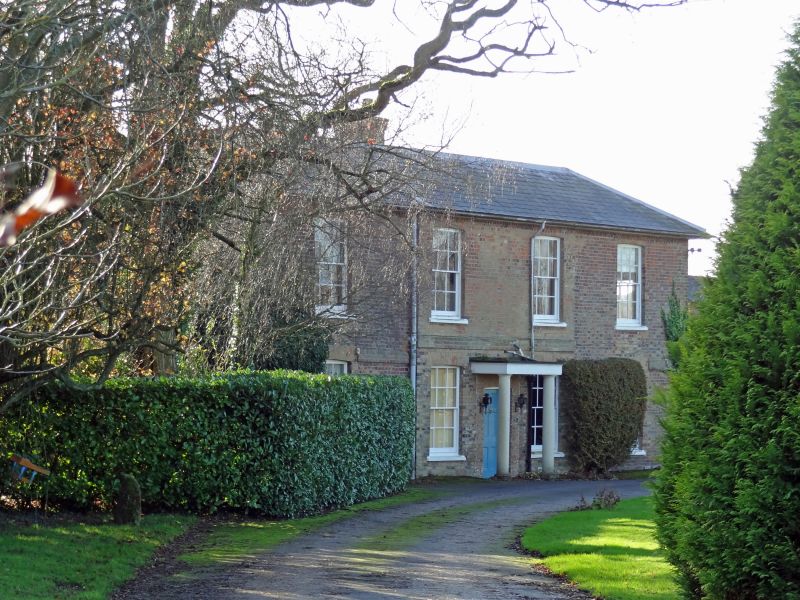
Farmhouse. c1830, on site of earlier building. Brick with slate roof. 2-storey, 4 x 2 bays, the 2 centre bays slightly broken forward and in red brick, flanking bays in diaper brick. Central 6-panel door with simple Roman Doric portico. 12-pane sashes with crown glass and concealed boxes under cambered brick wedge lintels. Stacks on gables. John Wesley stayed at Park Farm during his visits to the area.
Listing NGR: SU2552769698
External links are from the relevant listing authority and, where applicable, Wikidata. Wikidata IDs may be related buildings as well as this specific building. If you want to add or update a link, you will need to do so by editing the Wikidata entry.


Other nearby listed buildings