Latitude: 51.3857 / 51°23'8"N
Longitude: -2.0563 / 2°3'22"W
OS Eastings: 396179
OS Northings: 165185
OS Grid: ST961651
Mapcode National: GBR 2TK.2XW
Mapcode Global: VHB47.9FSK
Plus Code: 9C3V9WPV+7F
Entry Name: Bankside
Listing Date: 3 April 1987
Grade: II
Source: Historic England
Source ID: 1033917
English Heritage Legacy ID: 311159
ID on this website: 101033917
Location: Bromham, Wiltshire, SN15
County: Wiltshire
Civil Parish: Bromham
Built-Up Area: Bromham
Traditional County: Wiltshire
Lieutenancy Area (Ceremonial County): Wiltshire
Church of England Parish: Bromham, Chittoe and Sandy Lane
Church of England Diocese: Salisbury
Tagged with: Building
ST 9665 BROMHAM CHURCH HILL (north side)
10/9 Bankside
II GV
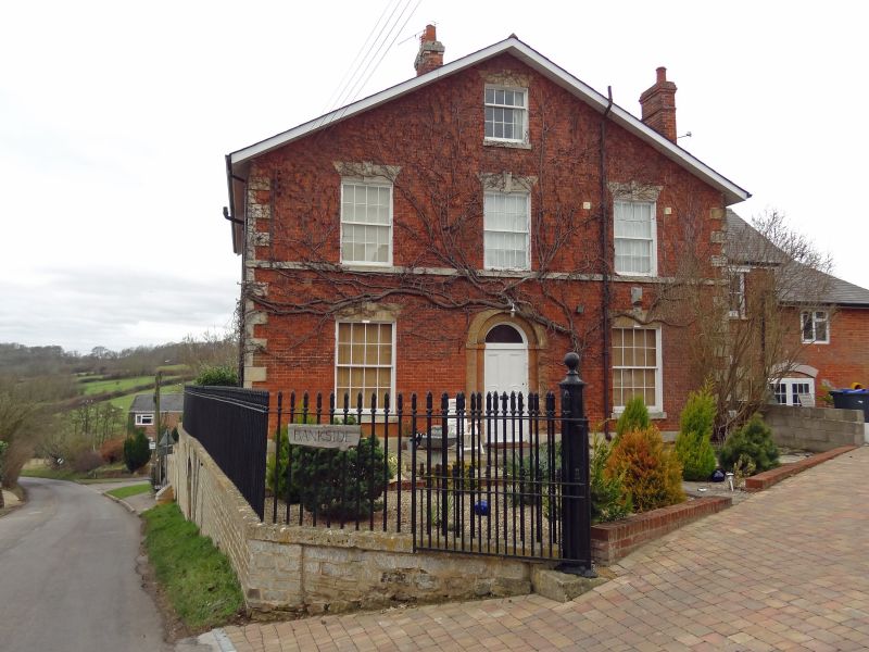
House, c1840, red brick with ashlar dressings and broad slate eaves roof. Two storeys and attic, square plan, gabled to front and rear. Ashlar rusticated quoins, plinth, first floor sill course, window sills, lintels and keystone and arched head to centre door. Three-window east front of 16-pane sashes with 12-pane sash to attic centre. Round-arched doorway recessed in arched surround with ashlar head, raised keystone and imposts. Plain fanlights. Two north wall stacks and 2 stacks on south roof slope. Similar rear, but plain cambered-head doorway and canted timber bay to ground floor right. Small 3-storey range to north with cambered- head casement pair windows and dentilled eaves. House was built for J. Banks, brewer, whose brewery adjoining was built in 1811, closed 1895 and is now demolished. House is prominently set above Church Hill and is included for group value. (H. Davis, A History of Bromham, 1965)
Listing NGR: ST9600065100
External links are from the relevant listing authority and, where applicable, Wikidata. Wikidata IDs may be related buildings as well as this specific building. If you want to add or update a link, you will need to do so by editing the Wikidata entry.


Other nearby listed buildings