Latitude: 52.1412 / 52°8'28"N
Longitude: 1.0801 / 1°4'48"E
OS Eastings: 610862
OS Northings: 253691
OS Grid: TM108536
Mapcode National: GBR TLM.PX7
Mapcode Global: VHLBC.NFWW
Plus Code: 9F4343RJ+F2
Entry Name: Pipps Ford
Listing Date: 9 December 1955
Last Amended: 26 March 1987
Grade: II
Source: Historic England
Source ID: 1033236
English Heritage Legacy ID: 279275
ID on this website: 101033236
Location: Mid Suffolk, IP6
County: Suffolk
District: Mid Suffolk
Civil Parish: Coddenham
Traditional County: Suffolk
Lieutenancy Area (Ceremonial County): Suffolk
Church of England Parish: Coddenham St Mary
Church of England Diocese: St.Edmundsbury and Ipswich
Tagged with: Building
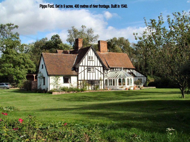
CODDENHAM KETTLE LANE TM 15 SW 7/27 Pipps Ford (formerly - 9-12-55 listed as Pip's Farmhouse) - II
Former farmhouse. Late C16 and C17, in 3 phases. Alterations of mid C19. Timber-framed; arch wind-braced studding largely exposed and blackened with plaster infill panels. A 2-storey C19 outshut along the front wall is in painted brick. Plaintiled roofs with 2 axial chimneys of red brick. 3-cell cross-entry plan. 2 storeys. Small-pane casements, mainly of C19. On the garden side are some original windows unblocked and glazed, with diamond and ovolo-moulded mullions. A 2-storey C17 entrance porch, at the cross-entry position, has the upper wall framing exposed; the moulded head of an original oriel survives above the entrance. C19 4-panelled door. A 2-cell C17 bakehouse-with-dairy is set forward to left. It was detached until C19, and has a little C18 cable-pattern pargetting. The hall and service cell of the house is the earliest phase, with plain framing; there is evidence for a rear cross-entry doorway with shallow arched head. The parlour block, of higher quality was added soon afterwards; the parlour has an ovolo moulded bridging joist. A further wing was added to rear of service end later in C17.
Listing NGR: TM1086253691
External links are from the relevant listing authority and, where applicable, Wikidata. Wikidata IDs may be related buildings as well as this specific building. If you want to add or update a link, you will need to do so by editing the Wikidata entry.


Other nearby listed buildings