Latitude: 52.2992 / 52°17'56"N
Longitude: 1.3352 / 1°20'6"E
OS Eastings: 627506
OS Northings: 272020
OS Grid: TM275720
Mapcode National: GBR WMP.VST
Mapcode Global: VHL9R.3G7T
Plus Code: 9F4378XP+M3
Entry Name: Studholme Farmhouse
Listing Date: 18 December 1987
Grade: II
Source: Historic England
Source ID: 1032869
English Heritage Legacy ID: 280146
ID on this website: 101032869
Location: Mid Suffolk, IP13
County: Suffolk
District: Mid Suffolk
Civil Parish: Laxfield
Traditional County: Suffolk
Lieutenancy Area (Ceremonial County): Suffolk
Church of England Parish: Laxfield All Saints
Church of England Diocese: St.Edmundsbury and Ipswich
Tagged with: Farmhouse
LAXFIELD TM 27 SE
4/26 Studholme Farmhouse -
-- II
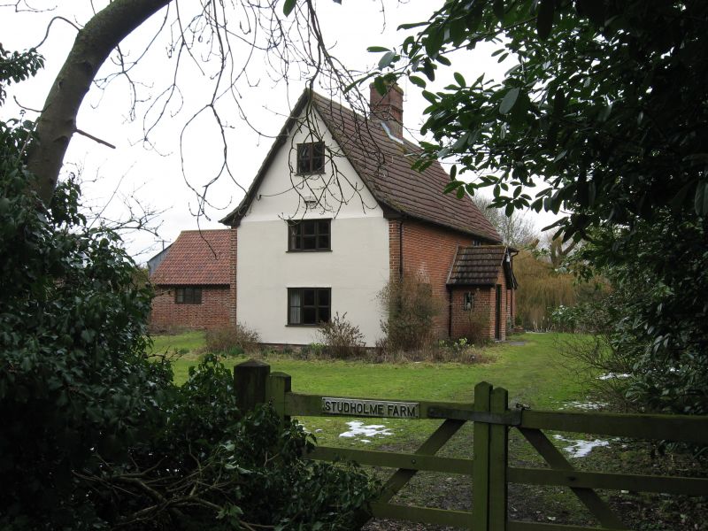
Farmhouse. Mid C16, with C15 service end to right. Timber framed, the long walls cased in C19 red brick. Roof of mid C20 concrete pantiles, half-hipped over the service end. 2 storeys and attic. C16 work has 2-cell lobby- entrance form. Mid C20 small-paned casement windows under segmental arches. Gabled brick porch with mid C20 door. Internal stack with recessed panels to front and rear; the upper part of the shaft has been rebuilt in plain form. C15 section is the service end of the previous house: some good first floor framing with reversed bracing; an intact diamond-mullioned window to ground floor and evidence for others; original sooted roof with a ridge piece. Much of the C16 work is concealed: one ground floor ceiling with chamfered joists and a good 6-light window with cavetto mullions in the chamber above. Original newel stairs in 2 flights. The queen-post roof over the right hand cell of the C16 range re-uses many components from the roof over the medieval hall which was of the same type. This house is a good example of the C16 rebuilding typical of farmhouses in the area, in this instance retaining one end of the medieval house unaltered.
Listing NGR: TM2750672020
External links are from the relevant listing authority and, where applicable, Wikidata. Wikidata IDs may be related buildings as well as this specific building. If you want to add or update a link, you will need to do so by editing the Wikidata entry.


Other nearby listed buildings