Latitude: 53.1729 / 53°10'22"N
Longitude: -1.2453 / 1°14'43"W
OS Eastings: 450541
OS Northings: 364241
OS Grid: SK505642
Mapcode National: GBR 8DX.3Z3
Mapcode Global: WHDFR.VH5Y
Plus Code: 9C5W5QF3+5V
Entry Name: Pleasley Bridge
Listing Date: 1 December 1997
Grade: II
Source: Historic England
Source ID: 1031532
English Heritage Legacy ID: 468971
ID on this website: 101031532
Location: Pleasley, Bolsover, Derbyshire, NG19
County: Derbyshire
District: Bolsover
Civil Parish: Pleasley
Built-Up Area: Mansfield
Traditional County: Derbyshire
Lieutenancy Area (Ceremonial County): Nottinghamshire
Church of England Parish: Mansfield, St Augustine and Pleaseley Hill, St Barnabas
Church of England Diocese: Southwell and Nottingham
SK 56 SW PLEASLEY CHESTERFIELD ROAD NORTH
1261/11/10006 Pleasley Bridge
- II
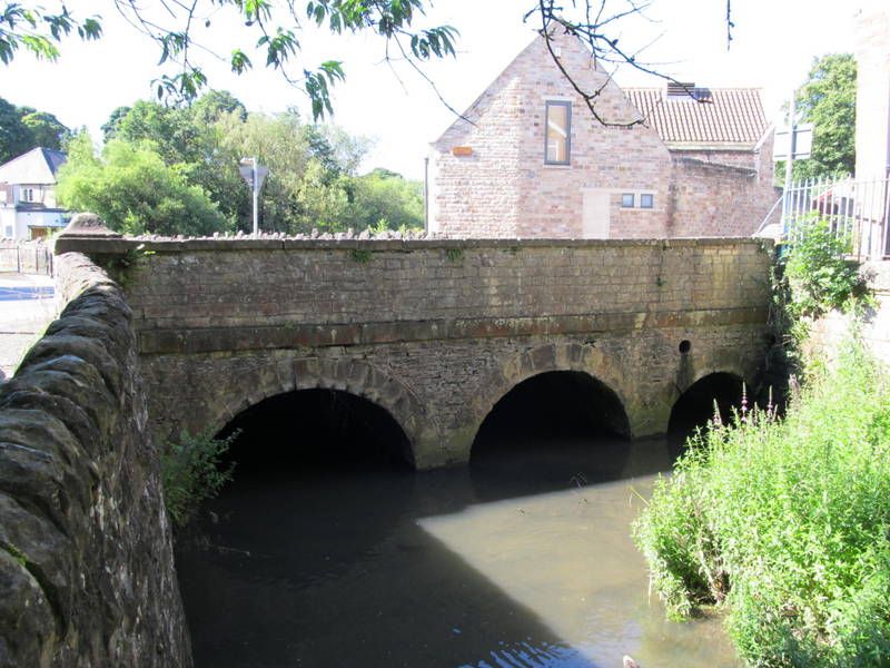
Road bridge spanning the River Meden. c.1800 with C20 alterations. Coursed squared stone and coursed rubble , with ashlar dressings. Bridge south side has 2 round arches with keystones, and smaller round arch to east. Impost band and parapet wall with rubble coping. North side has 2 plain round arches, and to west, a smaller round arch. parapet wall has slab coping and end piers and concave-sided square domed caps. The eastern section of this structure is within the parish of Mansfield, Mansfield District, Nottinghamshire
Listing NGR: SK5054164241
This text is from the original listing, and may not necessarily reflect the current setting of the building.


Other nearby listed buildings