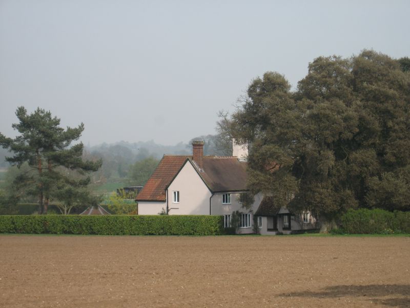
Latitude: 52.1652 / 52°9'54"N
Longitude: 1.4584 / 1°27'30"E
OS Eastings: 636616
OS Northings: 257526
OS Grid: TM366575
Mapcode National: GBR XQX.9JL
Mapcode Global: VHM7V.7VC0
Plus Code: 9F435F85+39
Entry Name: Firtree Farmhouse
Listing Date: 25 October 1984
Grade: II
Source: Historic England
Source ID: 1030862
English Heritage Legacy ID: 285177
ID on this website: 101030862
Location: Blaxhall, East Suffolk, IP12
County: Suffolk
District: East Suffolk
Civil Parish: Blaxhall
Traditional County: Suffolk
Lieutenancy Area (Ceremonial County): Suffolk
Church of England Parish: Blaxhall St Peter
Church of England Diocese: St.Edmundsbury and Ipswich
Tagged with: Farmhouse
BLAXHALL FARNHAM ROAD (farm track TM 35 NE off to east side) 3/4 Firtree Famhouse - - II Farmhouse. Late C17 - early C18. Much altered in C20. L plan. Lobby entrance. 4 bays. 2 storeys. Timber framed and plastered with plain tiled roofs. Scattered fenestration: C20 casements. C20 entrance porch and door. Axial red brick stack cement rendered. Moulded red brick stack to left hand end.Virtually intact timber frame.
Listing NGR: TM3661657526
External links are from the relevant listing authority and, where applicable, Wikidata. Wikidata IDs may be related buildings as well as this specific building. If you want to add or update a link, you will need to do so by editing the Wikidata entry.


Other nearby listed buildings