Latitude: 52.2194 / 52°13'9"N
Longitude: 1.2652 / 1°15'54"E
OS Eastings: 623132
OS Northings: 262937
OS Grid: TM231629
Mapcode National: GBR VM7.W45
Mapcode Global: VHLB2.WG6Y
Plus Code: 9F436798+Q3
Entry Name: The Rookery
Listing Date: 25 October 1951
Grade: II*
Source: Historic England
Source ID: 1030569
English Heritage Legacy ID: 285806
ID on this website: 101030569
Location: Earl Soham, East Suffolk, IP13
County: Suffolk
District: East Suffolk
Civil Parish: Earl Soham
Built-Up Area: Earl Soham
Traditional County: Suffolk
Lieutenancy Area (Ceremonial County): Suffolk
Church of England Parish: Earl Soham St Mary
Church of England Diocese: St.Edmundsbury and Ipswich
Tagged with: Architectural structure
TW 26 SW EARL SOHAM BRANDESTON ROAD
8/34 The Rookery 25.10.51
GV II*
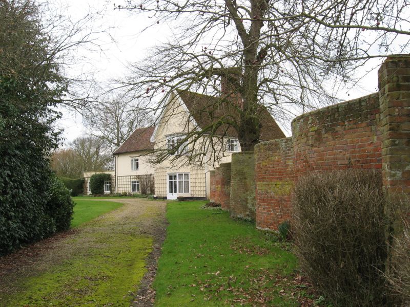
House. C16, the south wing largely rebuilt C19. L shape plan. South wing: red brick with colourwashed facade, plaintiles to front, pantiles to rear; 2 storeys; casement windows, one with leaded panes, cambered brick arches; doorway at the angle of the 2 ranges: 4-panel door, the upper 2 panels glazed with ornamental wrought iron infilling, pilasters, frieze and cornice; internal stack of sawtooth pattern, set forward of roof ridge. North wing: timber framed and plastered, the plaster double-lined in imitation of ashlar, plaintiled roof; 2 storeys; windows mainly C18 square leaded mullion and transom casements; gable end with C18 2-storey 3-light canted bay with modillion cornice. Fine internal stack with a cluster of 6 circular flues with moulded brick enrichment, moulded bases and renewed star caps. North wing has a fully panelled ground floor room with a fine C18 moulded plaster ceiling, believed to be of French or Italian workmanship.
Listing NGR: TM2313262937
External links are from the relevant listing authority and, where applicable, Wikidata. Wikidata IDs may be related buildings as well as this specific building. If you want to add or update a link, you will need to do so by editing the Wikidata entry.


Other nearby listed buildings