Latitude: 51.1929 / 51°11'34"N
Longitude: -0.4525 / 0°27'8"W
OS Eastings: 508235
OS Northings: 144877
OS Grid: TQ082448
Mapcode National: GBR GFM.0FZ
Mapcode Global: VHFVX.38NW
Plus Code: 9C3X5GVX+52
Entry Name: Quaker's Orchard
Listing Date: 14 June 1967
Last Amended: 21 May 1985
Grade: II
Source: Historic England
Source ID: 1029487
English Heritage Legacy ID: 288495
ID on this website: 101029487
Location: Peaslake, Guildford, Surrey, GU5
County: Surrey
District: Guildford
Civil Parish: Shere
Built-Up Area: Peaslake
Traditional County: Surrey
Lieutenancy Area (Ceremonial County): Surrey
Church of England Parish: Shere
Church of England Diocese: Guildford
Tagged with: Building
TQ 04 SE SHERE CP LAWBROOK LANE
10/228 Quaker's Orchard 14.6.67 (formerly listed as Quakers)
II
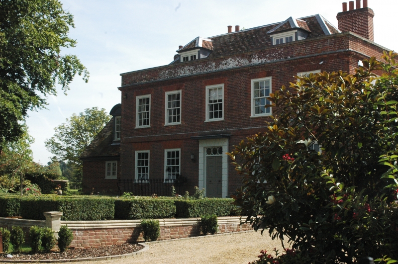
House, originally Quaker's house. C17 to rear right with C18 front and C20 extensions to left. Timber framed with sandstone rubble cladding, brick dressings to rear right, red brick front and hipped plain tiled roofs. Two storeys and attic under two hipped casement dormers over basement plinth with plat band over ground floor, and brick cornice to base of stone coped parapet. Rendered stack to right and end stacks to left and rear. Five first floor glazing bar sash windows under gauged brick heads with four windows below. Central glazed and panelled doors in rusticated surrounds with Voussoirs to top. Flat roofed porch hood and transome light over with three roundels. Cambered head basement windows. Leaded, wood framed casement windows to rear.
Listing NGR: TQ0823544877
External links are from the relevant listing authority and, where applicable, Wikidata. Wikidata IDs may be related buildings as well as this specific building. If you want to add or update a link, you will need to do so by editing the Wikidata entry.


Other nearby listed buildings