Latitude: 51.1491 / 51°8'56"N
Longitude: -0.3607 / 0°21'38"W
OS Eastings: 514758
OS Northings: 140143
OS Grid: TQ147401
Mapcode National: GBR HHF.ZKF
Mapcode Global: VHFW4.PCPZ
Plus Code: 9C3X4JXQ+JP
Entry Name: The Bakery and Post Office
Listing Date: 11 November 1966
Last Amended: 29 September 1987
Grade: II
Source: Historic England
Source ID: 1028702
English Heritage Legacy ID: 290336
ID on this website: 101028702
Location: Ockley, Mole Valley, Surrey, RH5
County: Surrey
District: Mole Valley
Civil Parish: Ockley
Built-Up Area: Ockley
Traditional County: Surrey
Lieutenancy Area (Ceremonial County): Surrey
Church of England Parish: Ockley, Okewood and Forest Green
Church of England Diocese: Guildford
Tagged with: Post office
OCKLEY C.P. STANE STREET TQ 14SW (East Side) 7/219 The Bakery and 11/11/66 Post Office (Formerly listed as The Shop, North of Surrey House) GV II
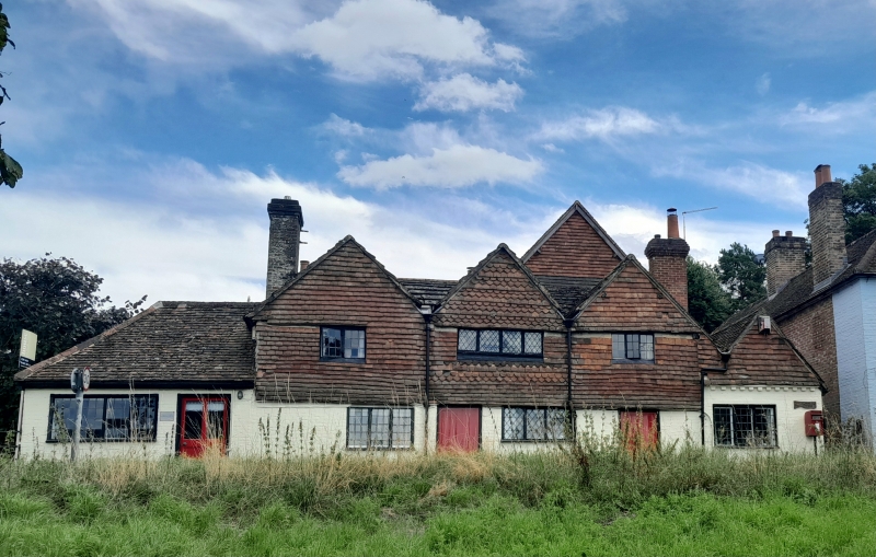
House, now shop to front. C17, with C19 extensions to rear and front left. Timber framed, clad in whitewashed brick below, tile hung above, some in alternate fish-scale and diamond-pane bands to centre gable. Plain tiled roofs to rear, Horsham slabs on front 3 gables. Two storeys with C19 stacks to left of left gable, taller C19 stack to rear right. Three gables across front with one leaded casement in first floor of each, one ground floor window to left and centre gable. Smaller gable with brick dentil band to right, and one ground floor 3-light casement. Hipped roof single storey to left with one 4-light leaded window and half-glazed door. Large C19 gable to rear right. Interior:- Some main posts surviving, the majority obscured.
Listing NGR: TQ1475840142
External links are from the relevant listing authority and, where applicable, Wikidata. Wikidata IDs may be related buildings as well as this specific building. If you want to add or update a link, you will need to do so by editing the Wikidata entry.


Other nearby listed buildings