Latitude: 51.0684 / 51°4'6"N
Longitude: 0.688 / 0°41'16"E
OS Eastings: 588423
OS Northings: 133329
OS Grid: TQ884333
Mapcode National: GBR QW3.SX2
Mapcode Global: FRA D6B9.7W5
Plus Code: 9F323M9Q+85
Entry Name: The Lemon Tree
Listing Date: 8 May 1950
Grade: II*
Source: Historic England
Source ID: 1025841
English Heritage Legacy ID: 179717
ID on this website: 101025841
Location: Tenterden, Ashford, Kent, TN30
County: Kent
District: Ashford
Civil Parish: Tenterden
Built-Up Area: Tenterden
Traditional County: Kent
Lieutenancy Area (Ceremonial County): Kent
Tagged with: Building
This list entry was subject to a Minor Amendment on 19 February 2024 to amend the name and address and reformat the text to current standards
TQ 8833
1/9
HIGH STREET (South Side)
Nos 29-33
(The Lemon Tree)
(Formerly listed as Nos 29, 31 & 33)
8.5.50.
GV
II*
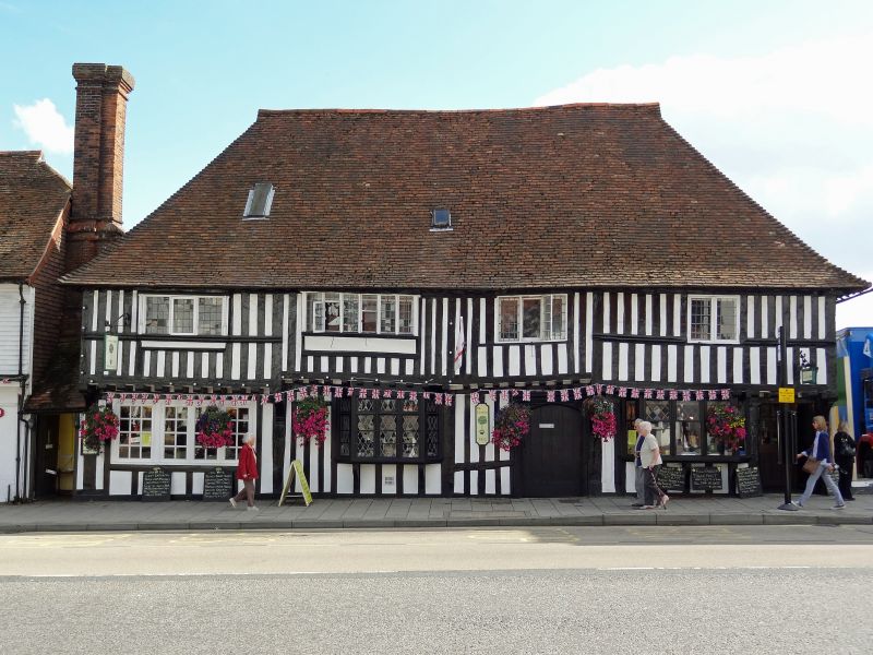
A C15 to C16 timber-framed house. Two storeys close-studded with plaster infill. The first floor overhangs on the protruding end of the floor joists and curved brackets. It originally had a recessed centre but this was jettied across in the C16 when the open hall was roofed over. Four windows. Hipped tiled roof. The first floor has C17 casement windows with small square panes and a moulded wooden stringcourse beneath them. Modern ground floor windows. Original four-centred doorcase in frame surmounted by embattlementation and with carved quatrefoils in the spandrels. Another plain doorway at the west end of the front. The side elevation has a curved brace exposed and weatherboarded extensions. Some contemporary panelling inside.
All the listed buildings on the South side from Nos 17 to 57 form a group.
Listing NGR: TQ8842633328
External links are from the relevant listing authority and, where applicable, Wikidata. Wikidata IDs may be related buildings as well as this specific building. If you want to add or update a link, you will need to do so by editing the Wikidata entry.


Other nearby listed buildings