Latitude: 51.7134 / 51°42'48"N
Longitude: -1.9659 / 1°57'57"W
OS Eastings: 402449
OS Northings: 201632
OS Grid: SP024016
Mapcode National: GBR 3QY.FSY
Mapcode Global: VHB2Q.W61B
Plus Code: 9C3WP27M+9J
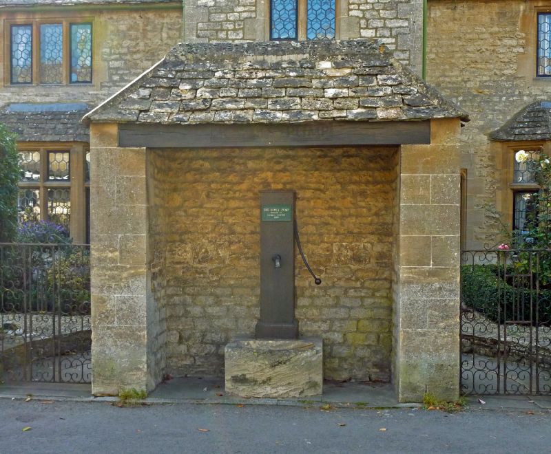
Entry Name: Bowly's Pump
Listing Date: 19 January 1981
Last Amended: 24 May 1993
Grade: II
Source: Historic England
Source ID: 1025117
English Heritage Legacy ID: 365467
ID on this website: 101025117
Location: Cirencester, Cotswold, Gloucestershire, GL7
County: Gloucestershire
District: Cotswold
Civil Parish: Cirencester
Built-Up Area: Cirencester
Traditional County: Gloucestershire
Lieutenancy Area (Ceremonial County): Gloucestershire
Church of England Parish: Cirencester St John the Baptist
Church of England Diocese: Gloucester
Tagged with: Building
CIRENCESTER
SP0201 WATERMOOR ROAD 578-1/6/329 (East side) 19/01/81 Bowly's Pump (Formerly Listed as: WATERMOOR ROAD Front boundary walls and pump house to Sarah Bowley Almshouses)
GV II
Pump and pump house. Pump 1864 re-sited. Pump house 1924-5 by N Jewson. Ashlar piers to front, coursed squared limestone rubble to sides and rear; stone slate hipped roof. Small rectangular structure open to front sheltering attached timber-encased pump and small stone trough with curved front. Timber lintel over opening has incised lettering BOWLY'S PUMP. Rear angles rounded off with roof corbelled out over. The pump was originally installed in 1864 as a gift to the almhouses and neighbourhood by Thomas Brewin. It was moved to its present site probably at the same time as the construction of the shelter, and also the Sarah Bowly Almshouses behind (q.v.). Included for group value. (DoE: List of Buildings of Special Architectural or Historic Interest: (amendment)).
Listing NGR: SP0244901631
External links are from the relevant listing authority and, where applicable, Wikidata. Wikidata IDs may be related buildings as well as this specific building. If you want to add or update a link, you will need to do so by editing the Wikidata entry.


Other nearby listed buildings