Latitude: 54.9673 / 54°58'2"N
Longitude: -1.6102 / 1°36'36"W
OS Eastings: 425056
OS Northings: 563705
OS Grid: NZ250637
Mapcode National: GBR SPR.CS
Mapcode Global: WHC3R.7DJT
Plus Code: 9C6WX98Q+WW
Entry Name: 35, Close
Listing Date: 29 June 1976
Last Amended: 30 March 1987
Grade: II*
Source: Historic England
Source ID: 1024918
English Heritage Legacy ID: 304500
Also known as: The Quayside
Lloyds No. 1 Bar
ID on this website: 101024918
Location: Gateshead, Newcastle upon Tyne, Tyne and Wear, NE1
County: Newcastle upon Tyne
Electoral Ward/Division: Westgate
Parish: Non Civil Parish
Built-Up Area: Newcastle upon Tyne
Traditional County: Northumberland
Lieutenancy Area (Ceremonial County): Tyne and Wear
Church of England Parish: St Nicholas Newcastle-upon-Tyne
Church of England Diocese: Newcastle
NZ 2563 NW NEWCASTLE UPON TYNE CLOSE (south side)
24/192 No. 35 (formerly listed 29/6/76 as premises occupied by Messrs. Doves) G.V. II*
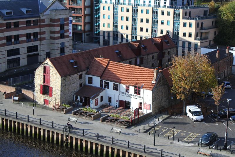
House and warehouses. Possibly Cl6 and later. Render; sandstone; brick with some ashlar dressings; timber frame; renewed pantiled roofs with some Welsh slate. 3 ranges, the rear originally on river edge but now facing onto artificial fill, around courtyard with enclosing wall on street front. High wide rendered wall, containing boarded double vehicle doors, links 2 rendered gables; tripartite sashes in left gable, wood-mullioned openings at right. Rendered house at rear of yard: 2 builds; left of 2 storeys, 3 bays with wide doorway at left, sash with glazing bars in centre and tripartite sash at right; upper-floor sash in wide box and Venetian window with broad glazing bars. Right build of 2 higher storeys and 2 bays projects slightly and has 6-panelled door in wooden architrave with bracketed cornice. First floor 2-light casement and renewed sash. Left range, of stone and brick in 2 builds, has 2 storeys, 5 and 5 bays. First build, attached to house, has varied openings with segmental brick arches, vehicle entrance at left and boarded door and overlight at right. Some sashes; upper wood-mullioned openings. Second build has first-floor 4-panelled door and sash windows. Slate roof hipped to street. Right range of stone has 2 storeys and attics, 8 irregular bays. Irregular stone arch to boarded ground-floor entrance in second bay; blocked arch in fifth bay has chamfered elliptical head. Stone steps to boarded door under stone lintel in third bay. Stacks of loading doors, the top under gable, in bays 4 and 7; crane above that in bay 7. Wood mullions to square openings with flat stone lintels on first floor; roof has 3 segmental-headed dormers. Interior of left range, first build, has arched tie beam and king-post roof, the ridge set in one side of broadened posts.
Listing NGR: NZ2505663705
External links are from the relevant listing authority and, where applicable, Wikidata. Wikidata IDs may be related buildings as well as this specific building. If you want to add or update a link, you will need to do so by editing the Wikidata entry.


Other nearby listed buildings