Latitude: 51.6296 / 51°37'46"N
Longitude: -1.7092 / 1°42'33"W
OS Eastings: 420224
OS Northings: 192345
OS Grid: SU202923
Mapcode National: GBR 4TL.SSK
Mapcode Global: VHC0Q.B98M
Plus Code: 9C3WJ7HR+R8
Entry Name: Stonecroft
Listing Date: 7 July 1976
Grade: II
Source: Historic England
Source ID: 1023338
English Heritage Legacy ID: 318360
ID on this website: 101023338
Location: Highworth, Swindon, Wiltshire, SN6
County: Swindon
Civil Parish: Highworth
Built-Up Area: Highworth
Traditional County: Wiltshire
Lieutenancy Area (Ceremonial County): Wiltshire
Church of England Parish: Highworth with Sevenhampton and Inglesham
Church of England Diocese: Bristol
Tagged with: Building
1. 5410 HIGHWORTH BREWERY STREET No 14 (Stonecroft) SU 2092 SW 18/250 7.7.76
II
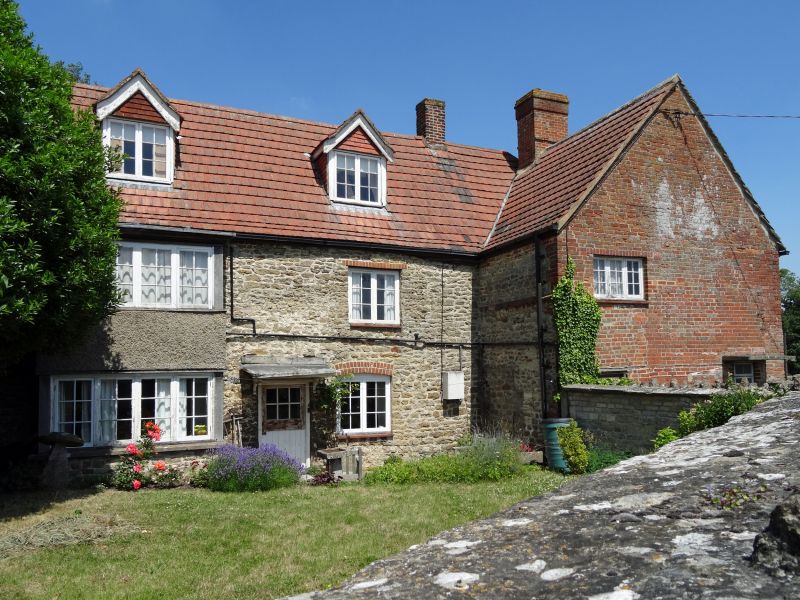
2. C18, possibly older. 'L' plan range in front of early C19 block towards the paddock. Rubble with flat pantile roof. Brick quoins to north gable, brick chimney to west gable. Entrance in modern porch in angle. Three-light C18 wood mullion window to north-over porch with moulded lintel. Garden front has 2 gabled dormers and half glazed door with bracketted hood. Towards the paddock: stone tile roof with central brick chimney, 2 windows on first floor, 3 on ground floor with stout wood mullions. Walled garden, rubble about 6-7 ft high to south with rubble farm building in south-east corner. Stable in north garden not included.
Listing NGR: SU2022492345
External links are from the relevant listing authority and, where applicable, Wikidata. Wikidata IDs may be related buildings as well as this specific building. If you want to add or update a link, you will need to do so by editing the Wikidata entry.


Other nearby listed buildings