Latitude: 51.4169 / 51°25'0"N
Longitude: -2.1211 / 2°7'15"W
OS Eastings: 391676
OS Northings: 168661
OS Grid: ST916686
Mapcode National: GBR 1RR.4K2
Mapcode Global: VH96K.6N15
Plus Code: 9C3VCV8H+QH
Entry Name: The Packhorse Bridge
Listing Date: 7 January 1987
Grade: II
Source: Historic England
Source ID: 1022181
English Heritage Legacy ID: 315562
ID on this website: 101022181
Location: Lacock, Wiltshire, SN15
County: Wiltshire
Civil Parish: Lacock
Built-Up Area: Lacock
Traditional County: Wiltshire
Lieutenancy Area (Ceremonial County): Wiltshire
Church of England Parish: Lacock with Bowden Hill
Church of England Diocese: Bristol
Tagged with: Bridge
LACOCK NETHERCOTE HILL ST 9168 4/126 The Packhorse Bridge GV II
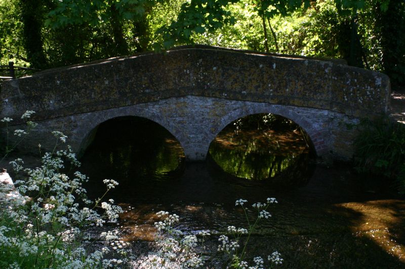
Bridge over Byde Brook, C18, rubble stone, humpbacked with ashlar parapet. Two small arches, ashlar lined. Projecting band beneath parapet. Marked as Dummer's Dridge on Tithe Map.
Listing NGR: ST9167668661
External links are from the relevant listing authority and, where applicable, Wikidata. Wikidata IDs may be related buildings as well as this specific building. If you want to add or update a link, you will need to do so by editing the Wikidata entry.


Other nearby listed buildings